← Back to map

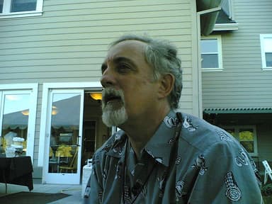
Mitch Kapor portrait
TechCelebrity profile

Mitch Kapor Private jet tracker

Follow…

Mitch Kapor — Lotus founder (USA). Gulfstream G650ER (N700MK).

Note · We track Mitch Kapor's planes, not Mitch Kapor in person. Flight data shows when and where each plane flew. It does not show who was on board.

Where is Mitch Kapor's private jet right now?

Loading live position

How much CO₂ do Mitch Kapor's private jet flights emit?

Over the last 31 completed flights we tracked, Mitch Kapor's private jet spent about 126 hours in the air. We estimate those flights put out 522.3 metric tons of CO₂.

Total flights

31

Total CO₂

522.3t

Flight hours

126h

What private jet does Mitch Kapor own?

We track one private jet for Mitch Kapor: a Gulfstream G650ER with tail number N700MK.

Where has Mitch Kapor's private jet flown?

These are the last 31 flights we tracked for Mitch Kapor's private jet, newest first. Open a flight to see its route map, time in the air, top altitude and speed.

CompletedN700MK
Aug 24, 2026, 12:02 PM
Departure
PANC — Ted Stevens Anchorage International Airport
Arrival
KIWA — Mesa Gateway Airport
Flight path
Flight path for Mitch Kapor's N700MK from PANC — Ted Stevens Anchorage International Airport to KIWA — Mesa Gateway Airport
Duration
4h 46m
Max altitude
45,050 ft
Max speed
554 kts
Arrived
Aug 24, 2026, 04:49 PM
CompletedN700MK
Aug 24, 2026, 05:02 AM
Departure
RJGG — Chubu Centrair International Airport
Arrival
PANC — Ted Stevens Anchorage International Airport
Flight path
Flight path for Mitch Kapor's N700MK from RJGG — Chubu Centrair International Airport to PANC — Ted Stevens Anchorage International Airport
Duration
6h 13m
Max altitude
45,025 ft
Max speed
563 kts
Arrived
Aug 24, 2026, 11:15 AM
CompletedN700MK
Aug 21, 2026, 08:33 AM
Departure
RJAH — Ibaraki Airport
Arrival
RJGG — Chubu Centrair International Airport
Flight path
Flight path for Mitch Kapor's N700MK from RJAH — Ibaraki Airport to RJGG — Chubu Centrair International Airport
Duration
33m
Max altitude
24,025 ft
Max speed
449 kts
Arrived
Aug 21, 2026, 09:06 AM
CompletedN700MK
Aug 21, 2026, 02:41 AM
Departure
RCSS — Taipei Songshan International Airport
Arrival
RJAA — Narita International Airport
Flight path
Flight path for Mitch Kapor's N700MK from RCSS — Taipei Songshan International Airport to RJAA — Narita International Airport
Duration
4h 54m
Max altitude
45,025 ft
Max speed
544 kts
Arrived
Aug 21, 2026, 07:35 AM
CompletedN700MK
Aug 18, 2026, 10:42 AM
Departure
RCSS — Taipei Songshan International Airport
Arrival
RCSS — Taipei Songshan International Airport
Flight path
Flight path for Mitch Kapor's N700MK from RCSS — Taipei Songshan International Airport to RCSS — Taipei Songshan International Airport
Duration
1h 50m
Max altitude
24,000 ft
Max speed
489 kts
Arrived
Aug 18, 2026, 12:33 PM
CompletedN700MK
Aug 18, 2026, 05:01 AM
Departure
RCSS — Taipei Songshan International Airport
Arrival
RCSS — Taipei Songshan International Airport
Flight path
Flight path for Mitch Kapor's N700MK from RCSS — Taipei Songshan International Airport to RCSS — Taipei Songshan International Airport
Duration
2h 32m
Max altitude
19,000 ft
Max speed
423 kts
Arrived
Aug 18, 2026, 07:34 AM
CompletedN700MK
Aug 18, 2026, 12:33 AM
Departure
RODN — Kadena Air Base
Arrival
RCSS — Taipei Songshan International Airport
Flight path
Flight path for Mitch Kapor's N700MK from RODN — Kadena Air Base to RCSS — Taipei Songshan International Airport
Duration
2h 37m
Max altitude
22,925 ft
Max speed
469 kts
Arrived
Aug 18, 2026, 03:10 AM
CompletedN700MK
Aug 15, 2026, 11:43 PM
Departure
PANC — Ted Stevens Anchorage International Airport
Arrival
ROAH — Naha International Airport
Flight path
Flight path for Mitch Kapor's N700MK from PANC — Ted Stevens Anchorage International Airport to ROAH — Naha International Airport
Duration
10h 59m
Max altitude
43,025 ft
Max speed
533 kts
Arrived
Aug 16, 2026, 10:42 AM
CompletedN700MK
Aug 15, 2026, 12:40 PM
Departure
LFPB — Paris-Le Bourget International Airport
Arrival
PANC — Ted Stevens Anchorage International Airport
Flight path
Flight path for Mitch Kapor's N700MK from LFPB — Paris-Le Bourget International Airport to PANC — Ted Stevens Anchorage International Airport
Duration
9h 39m
Max altitude
43,025 ft
Max speed
518 kts
Arrived
Aug 15, 2026, 10:19 PM
CompletedN700MK
Aug 11, 2026, 03:01 PM
Departure
LSMD — Dübendorf Air Base
Arrival
LFPB — Paris-Le Bourget International Airport
Flight path
Flight path for Mitch Kapor's N700MK from LSMD — Dübendorf Air Base to LFPB — Paris-Le Bourget International Airport
Duration
51m
Max altitude
31,000 ft
Max speed
511 kts
Arrived
Aug 11, 2026, 03:53 PM
CompletedN700MK
Aug 9, 2026, 03:35 PM
Departure
LIML — Milano Linate Airport
Arrival
LSZH — Zürich Airport
Flight path
Flight path for Mitch Kapor's N700MK from LIML — Milano Linate Airport to LSZH — Zürich Airport
Duration
37m
Max altitude
24,025 ft
Max speed
441 kts
Arrived
Aug 9, 2026, 04:12 PM
CompletedN700MK
Aug 5, 2026, 02:22 AM
Departure
PANC — Ted Stevens Anchorage International Airport
Arrival
LIML — Milano Linate Airport
Flight path
Flight path for Mitch Kapor's N700MK from PANC — Ted Stevens Anchorage International Airport to LIML — Milano Linate Airport
Duration
10h 45m
Max altitude
45,025 ft
Max speed
547 kts
Arrived
Aug 5, 2026, 01:08 PM
CompletedN700MK
Aug 4, 2026, 06:21 PM
Departure
RJTT — Tokyo Haneda International Airport
Arrival
PANC — Ted Stevens Anchorage International Airport
Flight path
Flight path for Mitch Kapor's N700MK from RJTT — Tokyo Haneda International Airport to PANC — Ted Stevens Anchorage International Airport
Duration
6h 30m
Max altitude
45,025 ft
Max speed
550 kts
Arrived
Aug 5, 2026, 12:52 AM
CompletedN700MK
Aug 3, 2026, 06:10 AM
Departure
RJGG — Chubu Centrair International Airport
Arrival
RJTT — Tokyo Haneda International Airport
Flight path
Flight path for Mitch Kapor's N700MK from RJGG — Chubu Centrair International Airport to RJTT — Tokyo Haneda International Airport
Duration
35m
Max altitude
25,000 ft
Max speed
474 kts
Arrived
Aug 3, 2026, 06:45 AM
CompletedN700MK
Aug 2, 2026, 02:37 AM
Departure
RJTT — Tokyo Haneda International Airport
Arrival
RJOE — JGSDF Akeno Airfield
Flight path
Flight path for Mitch Kapor's N700MK from RJTT — Tokyo Haneda International Airport to RJOE — JGSDF Akeno Airfield
Duration
47m
Max altitude
24,000 ft
Max speed
477 kts
Arrived
Aug 2, 2026, 03:25 AM
CompletedN700MK
Aug 1, 2026, 12:31 AM
Departure
KMDW — Chicago Midway International Airport
Arrival
RJTT — Tokyo Haneda International Airport
Flight path
Flight path for Mitch Kapor's N700MK from KMDW — Chicago Midway International Airport to RJTT — Tokyo Haneda International Airport
Duration
11h 53m
Max altitude
46,950 ft
Max speed
555 kts
Arrived
Aug 1, 2026, 12:25 PM
CompletedN700MK
Jul 31, 2026, 03:35 PM
Departure
52.14°, -4.97°
Arrival
KORD — Chicago O'Hare International Airport
Flight path
Flight path for Mitch Kapor's N700MK from 52.14°, -4.97° to KORD — Chicago O'Hare International Airport
Duration
7h 0m
Max altitude
43,025 ft
Max speed
522 kts
Arrived
Jul 31, 2026, 10:36 PM
CompletedN700MK
Jul 29, 2026, 01:42 PM
Departure
ESSA — Stockholm-Arlanda Airport
Arrival
EGLF — Farnborough Airport
Flight path
Flight path for Mitch Kapor's N700MK from ESSA — Stockholm-Arlanda Airport to EGLF — Farnborough Airport
Duration
2h 2m
Max altitude
42,975 ft
Max speed
510 kts
Arrived
Jul 29, 2026, 03:44 PM
CompletedN700MK
Jul 27, 2026, 12:56 PM
Departure
LSMP — Payerne Air Base
Arrival
58.45°, 17.45°
Flight path
Flight path for Mitch Kapor's N700MK from LSMP — Payerne Air Base to 58.45°, 17.45°
Duration
1h 34m
Max altitude
41,000 ft
Max speed
556 kts
Arrived
Jul 27, 2026, 02:30 PM
CompletedN700MK
Jul 25, 2026, 12:52 PM
Departure
55.52°, -1.03°
Arrival
LSMP — Payerne Air Base
Flight path
Flight path for Mitch Kapor's N700MK from 55.52°, -1.03° to LSMP — Payerne Air Base
Duration
1h 26m
Max altitude
45,025 ft
Max speed
569 kts
Arrived
Jul 25, 2026, 02:18 PM
CompletedN700MK
Jul 24, 2026, 07:47 PM
Departure
RJTT — Tokyo Haneda International Airport
Arrival
37.73°, 144.71°
Flight path
Flight path for Mitch Kapor's N700MK from RJTT — Tokyo Haneda International Airport to 37.73°, 144.71°
Duration
56m
Max altitude
41,000 ft
Max speed
534 kts
Arrived
Jul 24, 2026, 08:43 PM
CompletedN700MK
Jul 23, 2026, 06:05 AM
Departure
RJGG — Chubu Centrair International Airport
Arrival
RJTT — Tokyo Haneda International Airport
Flight path
Flight path for Mitch Kapor's N700MK from RJGG — Chubu Centrair International Airport to RJTT — Tokyo Haneda International Airport
Duration
42m
Max altitude
25,000 ft
Max speed
500 kts
Arrived
Jul 23, 2026, 06:48 AM
CompletedN700MK
Jul 2, 2026, 02:40 AM
Departure
RJTT — Tokyo Haneda International Airport
Arrival
RJGG — Chubu Centrair International Airport
Flight path
Flight path for Mitch Kapor's N700MK from RJTT — Tokyo Haneda International Airport to RJGG — Chubu Centrair International Airport
Duration
54m
Max altitude
24,000 ft
Max speed
391 kts
Arrived
Jul 2, 2026, 03:35 AM
CompletedN700MK
Jul 1, 2026, 12:00 AM
Departure
KBFI — King County International Airport - Boeing Field
Arrival
RJTT — Tokyo Haneda International Airport
Flight path
Flight path for Mitch Kapor's N700MK from KBFI — King County International Airport - Boeing Field to RJTT — Tokyo Haneda International Airport
Duration
9h 25m
Max altitude
43,050 ft
Max speed
508 kts
Arrived
Jul 1, 2026, 09:26 AM
CompletedN700MK
Jun 30, 2026, 08:33 PM
Departure
CKX8 — Big River Airport
Arrival
KBFI — King County International Airport - Boeing Field
Flight path
Flight path for Mitch Kapor's N700MK from CKX8 — Big River Airport to KBFI — King County International Airport - Boeing Field
Duration
1h 44m
Max altitude
47,025 ft
Max speed
529 kts
Arrived
Jun 30, 2026, 10:18 PM
CompletedN700MK
Jun 30, 2026, 03:25 PM
Departure
63.30°, -17.23°
Arrival
CCB2 — Seabee Mine Airport
Flight path
Flight path for Mitch Kapor's N700MK from 63.30°, -17.23° to CCB2 — Seabee Mine Airport
Duration
4h 49m
Max altitude
40,025 ft
Max speed
553 kts
Arrived
Jun 30, 2026, 08:15 PM
CompletedN700MK
Jun 30, 2026, 01:15 PM
Departure
LFPB — Paris-Le Bourget International Airport
Arrival
63.14°, -16.66°
Flight path
Flight path for Mitch Kapor's N700MK from LFPB — Paris-Le Bourget International Airport to 63.14°, -16.66°
Duration
2h 9m
Max altitude
40,000 ft
Max speed
530 kts
Arrived
Jun 30, 2026, 03:25 PM
CompletedN700MK
Jun 27, 2026, 02:08 PM
Departure
LSGG — Geneva International Airport
Arrival
LFPB — Paris-Le Bourget International Airport
Flight path
Flight path for Mitch Kapor's N700MK from LSGG — Geneva International Airport to LFPB — Paris-Le Bourget International Airport
Duration
54m
Max altitude
26,000 ft
Max speed
481 kts
Arrived
Jun 27, 2026, 03:03 PM
CompletedN700MK
Jun 26, 2026, 12:32 PM
Departure
GB-0448 — Slieve Croob Airfield
Arrival
LSGG — Geneva International Airport
Flight path
Flight path for Mitch Kapor's N700MK from GB-0448 — Slieve Croob Airfield to LSGG — Geneva International Airport
Duration
1h 51m
Max altitude
41,025 ft
Max speed
510 kts
Arrived
Jun 26, 2026, 02:23 PM
CompletedN700MK
Jun 26, 2026, 05:29 AM
Departure
KOMK — Omak Airport
Arrival
IE-0051 — Carrigart Airstrip
Flight path
Flight path for Mitch Kapor's N700MK from KOMK — Omak Airport to IE-0051 — Carrigart Airstrip
Duration
7h 3m
Max altitude
41,050 ft
Max speed
564 kts
Arrived
Jun 26, 2026, 12:32 PM
CompletedN700MK
Jun 25, 2026, 08:03 PM
Departure
35.22°, 142.05°
Arrival
KBFI — King County International Airport - Boeing Field
Flight path
Flight path for Mitch Kapor's N700MK from 35.22°, 142.05° to KBFI — King County International Airport - Boeing Field
Duration
7h 40m
Max altitude
41,000 ft
Max speed
588 kts
Arrived
Jun 26, 2026, 03:44 AM

Owner matches come from the FAA registry, adsb.lol (ODbL) and ADSB.fi data, and SEC filings. They may be incomplete or out of date. Methodology · Report an error. For observational use only.